The ST6 Backyard—What Singletrack Dreams are Made Of!

Fisher Peak from Cranbrook, BC.
Our backyard is one-of-a-kind. It’s vast and it’s home to some of the best mountain biking terrain in the world. That terrain is shaped by two important and distinct mountain groups in Western Canada—the Canadian Rockies and the Columbia Mountains. These groups provide a canvas for trail builders to shape and gain inspiration from. They’re the foundation for every route and stage we plan. And, without them, we wouldn’t be able to bring our riders new, top-notch, singletrack routes every year.
But the Columbia and Rocky Mountains are also about more than just singletrack, they’re adventure centres that attract millions of visitors every year. Their geography and rich history make the mountains in our backyard unique. We think they deserve recognition, so let’s take a quick tour!
First Nations & Metis Territories
While we call the lands we use for Singletrack 6 our “backyard”, we’re only visitors. So we’d like to take this opportunity to recognize that in any given year, the event can and does take place on the unceded territory of the Okanagan, Shuswap, Ktunaxa, Tsuu T’ina, Stoney, Blackfoot, Sinixt and Metis Nations.
If you’d like to learn more about these Nations—and many others—a website called Native Land is a great place to start. There you’ll find a wealth of information on the subject and some direction as to where you can find even more.
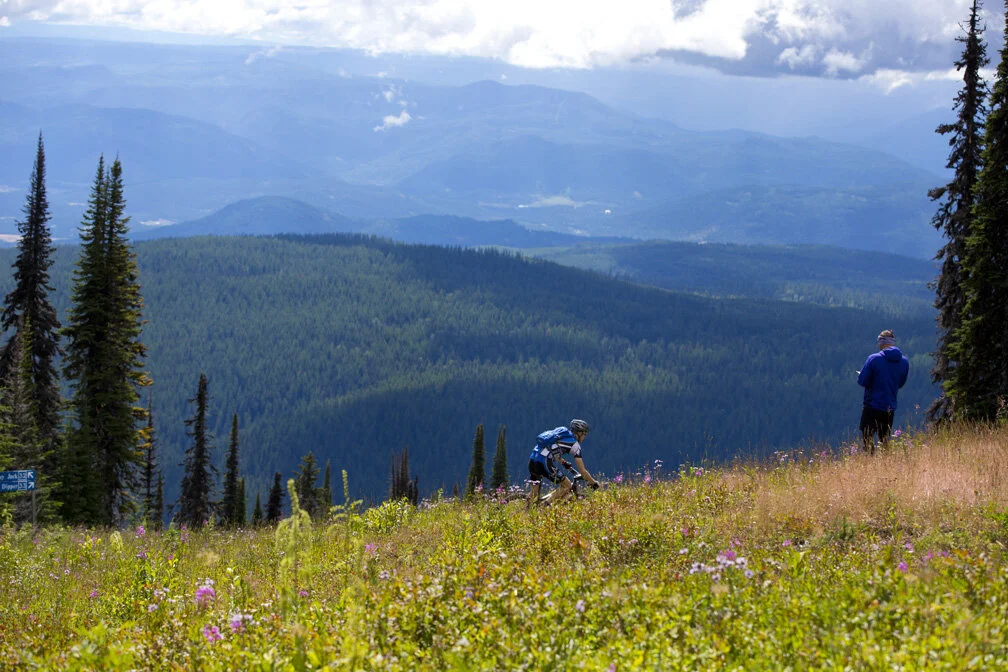
The Mountain Ranges of Singletrack 6

Riding high west of Invermere in the Columbia Valley
Western Canada is home to three major mountain groups. From east to west they are: the Rocky Mountains (Canadian Rockies), the Columbia Mountains and the Coast Mountains. Each one is further divided into ranges and sub-ranges. We consider the southern portions of the Rocky and Columbia Mountains to be our backyard and our events take place in one —or sometimes both of these ranges on any given year. Combined, they cover an area roughly 25% larger than New Zealand.
How do we know where one set of mountains ends and the other begins? Well, the Rocky and Columbia Mountains are divided by a geographical feature known as The Rocky Mountain Trench. Essentially, the trench is a large valley that runs north/south and ranges in width from 3 to 16km. The Columbia and Kootenay Rivers as well as highways BC93 and BC95 run along the bottom of the trench, further delineating the boundary.
Interestingly, three of our host communities—Golden, Radium Hot Springs and Invermere—are located in the trench itself. This means riders could be on either the Columbia or Rocky Mountains, depending on which side of the valley they happen to be riding.
The Columbia and Rocky Mountains are each divided into a number of smaller mountain ranges, and those are again divided into sub-ranges. And, save for the three communities mentioned above, all of our host communities are solidly located in one or the other.
The Rocky Mountains (Canadian Rockies)
The Canadian Rockies are where the TransRockies Race Series got our start—it’s in our name, after all—back in the early 2000s with the TransRockies Challenge. And the mountains are home to our longest-running, and most visited host community: Fernie, British Columbia.
A Bit of Geography
Located between the western edge of the Canadian Prairies and the eastern edge of the Rocky Mountain Trench, the Canadian Rockies cover an area of 194,000km² (or 75,000 sq. miles).
The southern portion—where our events take place—straddles the Alberta, British Columbia border, which is defined by the continental divide. Generally speaking, the continental divide is the continental high point and splits drainage flows between east and west. All this is to say that rivers on the Alberta side of the divide flow east, and the water ultimately ends up in either the Arctic Ocean or Hudson’s Bay. And drainages on the British Columbia side flow west, and the water ultimately ends up in the Pacific Ocean.
The highest mountain in the Canadian Rockies is Mount Robson at 3954m (or 12,972ft) and is located in British Columbia. The highest Mountain on the Alberta side of the Rockies is Mount Columbia at 3747m (or 12,293 ft). The bulk of the Canadian Rockies are composed of layered sedimentary rock such as limestone and shale.
The whole of the Canadian portion of the Rocky Mountains can be divided into two sets of mountain range groupings: the Northern Ranges and the Continental Ranges (at the southern end). Singletrack 6 host communities are located within the Continental ranges. Unfortunately, there doesn’t seem to be a solid consensus on the boundaries of sub-ranges within the Canadian Rockies, but the Front, Park and Kootenay Ranges are commonly used names.
Fun Facts!

Nipika Mountain Resort
In addition to straddling the continental divide, the Canadian Rockies are home to five National parks: Banff, Jasper, Kootenay, Yoho and Waterton. The first four parks on that list are clustered together and along with three provincial parks—Hamber, Mount Assiniboine and Mount Robson—were named a UNESCO World Heritage Site in 1984. The last—Waterton National Park—is located at the southernmost end of the Canadian Rockies and connects with Glacier National Park in the United States. Banff National Park was Canada’s first and was established in 1885. Altogether the mountain parks that make up the UNESCO World Heritage Sites are visited by more than 9 million tourists annually and cover 23,600km² (or 14,664 sq. miles).
Past, present and future Singletrack 6 host communities with routes in the Canadian Rockies include Canmore, West Bragg Creek, Crowsnest Pass, Nipika and Fernie.
The Columbia Mountains
When the TransRockies Challenge transformed into Singletrack 6 in 2014, the new format allowed us to branch out and extend our backyard beyond the Rockies. Luckily for us, right next door were the Columbia Mountains, home to legendary and longstanding mountain biking meccas like Nelson and Rossland, British Columbia.
A Bit of Geography
West of the Rocky Mountain Trench lies the Columbia Mountains. At 135,952km² (or 52,491 sq miles) they are smaller in area than the Canadian Rockies but are home to huge amounts of exceptional singletrack!
Major drainages in the Columbia Mountains include the Kootenay, Columbia and Duncan Rivers. In fact, the Columbia River is one of the largest rivers in North America. By the time it reaches the ocean near Portland, Oregon, it’s releasing more water into the Pacific than any other river on the continent. The highest peak in the Columbia Mountains is Mount Sir Sandford at 3,519m (or 11,545ft).
Unlike the Canadian Rockies, the Columbia Mountains can be divided up into four commonly agreed-upon mountain ranges. Up north is the Cariboo Range, and to the south from east to west, are the Purcells, the Selkirks and the Monashees. Kootenay Lake and the Duncan River separate the Purcells and Selkirks, while the Columbia River and Arrow Lakes separate the Selkirks from the Monashees.
Fun facts!
Silverstar Mountain Resort
In contrast to the seven national parks of the Canadian Rockies, the Columbia mountains are only home to one, but it’s one with a storied history. Glacier National Park—not to be confused with the US park by the same name—was established in 1886 and covers 1,349 km2 (or 521 sq mi). The park is home to Rogers Pass, a high mountain pass discovered in 1881 by an expedition led by Major Albert Bowman Rogers. Importantly, the discovery of Roger’s pass was the final piece of the puzzle that allowed the building of a trans-Canadian railway that finally connected the Pacific Ocean and Eastern Canada. Later, in 1963, the Trans Canada Highway was also built through the pass.
Rogers Pass and the surrounding mountains receive a lot of snow through the winter months. And as a result, rail and highway routes through the pass have always been plagued by avalanches. Early on, frequent avalanches led to the building of snow sheds over avalanche-prone sections of the railroad. Later, railway tunnels were built under the pass to protect trains, including the 14.7km (9.1mi) Mount McDonald Tunnel, the longest railway tunnel in North America. Snow sheds are still used today to protect the highway and avalanche control is carried out regularly. Parks Canada, provincial highway crews and the Canadian Armed Forces all work together to keep the pass open. Parks Canada staff monitor and predict avalanche probability and The Royal Canadian Horse Artillery operates 105mm Howitzer cannons from different positions along the highway. During artillery avalanche control, the highway is closed and artillery rounds are fired at known avalanche trigger points.
Past and present Singletrack 6 host communities with routes in, or adjacent to, the Columbia Mountains include Vernon, Silver Star Resort, Kelowna, Penticton, Salmon Arm, Revelstoke, Cranbrook, Nelson, Rossland, Kimberly and Kaslo.
A New Adventure Every Year!
As you can see, we have a huge backyard. The Canadian Rockies and the Columbia Mountains provide a seemingly endless supply of world-class singletrack that allows us to keep things fresh year after year. Our host communities are always building new trails, and we’re always looking for—and finding—new host communities to visit. We hope you’ll join us in exploring our backyard and find out what singletrack dreams are made of!
We Want to Hear From You!
Have you had the opportunity to ride in the Canadian Rockies or the Columbia Mountains? Or both?
Which is your favourite? Why?
Let us know in the comments section below.